Restoration and Monitoring Activities in the Barataria-Terrebonne National Estuary
Measuring the effectiveness of CCMP actions in bringing about environmental change is accomplished with the monitoring of a suite of indicators. Many BTNEP partners and BTNEP Management Conference Members conduct monitoring and restoration activities in the estuary. Below are links to our partners who are gathering this important data and sharing it with us.
This resource of monitoring and restoration activities summarizes lead agencies, types of data gathered, and other pertinent information.
Please refer to the CCMP Action Plans for full descriptions of developed management strategies to meet adopted goals and targets and the actions needed to accomplish those strategies.
Coordination, collaboration, and long-term support for monitoring are key elements to success of the monitoring plan. BTNEP will continue to work with multiple agencies and partners to obtain, share, and evaluate monitoring data and to communicate findings to the public, decision makers, and stakeholders.
Partners
Click image to see data
CRMS – Coastwide Reference Monitoring System
The Coastal Planning, Protection and Restoration Act (CWPPRA) Task Force maintains and funds an extensive monitoring and ground assessment of approximately 390 monitoring sites across the coast. This project is called the Coastwide Reference Monitoring System (CRMS).
Monitoring data from CWPPRA for CRMS includes information on:
- water level,
- salinity,
- sediment accretion,
- surface elevation change,
- composition and abundance of vegetation, ration of land and water,
- and soil characteristics.
The CRMS project, under the direction of CWPPRA, is one of the largest coastal habitat monitoring networks in the United States. The CRMS team effectively delivers data to a variety of audiences with roughly 60 scientists employed to go out into the field to collect data.
CIMS – Coastal Information Management System
The Louisiana Coastal Protection and Restoration Authority’s (CPRA) has created a Coastal Information Management System (CIMS) to provide useful monitoring and project data to the public.
CIMS provides geospatial, tabular database and document access to CPRA’s suite of protection and restoration projects, Coastwide Reference Monitoring System (CRMS) stations, the 2017 Master Plan, geophysical data, and coastal community resiliency information. Full metadata information is available.
In addition to the aforementioned data this site has information on
- land change over time
- flood risk
- social vulnerability
- coastal vegetation
- resources to reduce flood risks

NEP Map – National Estuary Program Map Interface
The Environmental Protection Agency (EPA) provides funding for National Estuary Programs (NEPs) across the United States. This map explores the National Estuary Program habitat protection and restoration projects along with other key water quality and land use data. BTNEP information can be found in the highlighted light purple area of Louisiana.
Louisiana Department of Water Quality (LDEQ) – Monitoring Data
LDEQ collects surface water quality data in its Ambient Water Quality Monitoring Program as well as for other projects in water bodies across the state. Ambient water quality data, as well as other water project data, collected by LDEQ is available by accessing the LEAU Web Portal.
This water quality data is used for establishing water quality criteria or standards, assessment of conditions, and development of Total Maximum Daily Loads (TMDLs). TMDLs are one means of establishing water quality discharge permit limits and Nonpoint Source Pollution reduction recommendations for the protection and improvement of surface water quality in Louisiana.
Water quality data may also be obtained by contacting the LDEQ Public Records Group. For questions regarding the LDEQ Ambient Water Quality Monitoring Program, Mercury Initiative or other programs, please contact the Water Planning and Assessment Division.

The U.S. Geological Survey (USGS) – Water Data for the Nation
The USGS National Water Information System (NWIS) contains surface-water, groundwater, water-quality, and water-use data collected at approximately 1.5 million sites across all 50 states.
The USGS investigates the occurrence, quantity, quality, distribution, and movement of surface and underground waters and disseminates the data to the public, State and local governments, public and private utilities, and other Federal agencies involved with managing our water resources. You can access this information on the web.
The U.S. Geological Survey (USGS) – Louisiana Hydrowatch and WaterWatch
Additionally, USGS has a page specifically for Louisiana. The real-time data includes streamflow, groundwater, precipitation, and water quality parameters such as temperature, gage height, turbidity, dissolved oxygen, pH, and salinity.
Historical data is archived on this site as well as flood and hurricane information.
Louisiana Department of Health (LDH)
The Louisiana Department of Health (LDH) protects and promotes health and ensures the safety of drinking water in the state through active monitoring and sampling. Additionally, LDH monitors beaches for standards for primary human contact. LDH is also responsible for monitoring waters that produce oysters.
LDH – Drinking Water Watch Monitoring Program
Safe Drinking Water Program monitors over 1,300 public drinking water systems throughout Louisiana to ensure compliance with state and federal drinking water regulations so residents, visitors and tourists have access to safe, clean water. The Safe Drinking Water Program staff collect, analyze and review water system samples to ensure each system does not violate contaminant levels and is meeting monitoring, analytical and treatment technique requirements.
LDH – Revised Total Coliform Rule
LDH wants to increase public health protection through the reduction of potential pathways of entry for fecal contamination into water distribution systems. The Revised Total Coliform Rule (RTCR) establishes a maximum contaminant level (MCL) for E. coli and uses E. coli and total coliforms to initiate a “find and fix” approach to address fecal contamination that could enter into the water distribution system. It requires public water systems (PWSs) to perform assessments to identify sanitary defects and subsequently take action to correct them.
LDH – Beach Monitoring Program
The Louisiana Department of Health Beach Monitoring Program tests water at 24 beach sites along the Louisiana coast to determine whether the water quality meets Environmental Protection Agency (EPA) criteria. This program is part of the federal Beaches Environmental Assessment and Coastal Health (BEACH) Act of 2000. The BEACH Act is an amendment to the Clean Water Act requiring all coastal states to develop programs for effective water quality monitoring and public notification at coastal recreational beaches.
LDH analyzes the beach water for enterococci bacteria. These bacteria represent those commonly found in sewage pollution, and which could cause disease, infections or rashes. These analyses are performed on a weekly basis from April 1st through October 31st.
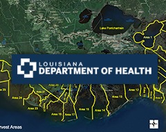
LDH – Molluscan Shellfish Monitoring Program
The Molluscan Shellfish Program is the regulatory agency for the oyster harvesting waters along Louisiana Gulf Coast. The harvesting areas are set forth by the Louisiana Sanitary Code and the National Shellfish Sanitation Program (NSSP). The NSSP is the federal/state cooperative program recognized by the U.S. Food and Drug Administration (USFDA) and the Interstate Shellfish Sanitation Conference (ISSC) for the sanitary control of shellfish produced and sold for human consumption. All oyster related facilities must adhere to the NSSP.
Oil Spill Monitoring Information – U.S. Coast Guard National Response Center (NRC)
The National Response Center (NRC) is not a response agency. It serves as an emergency call center that fields INITIAL reports for pollution and railroad incidents and forwards that information to appropriate federal/state agencies for response. The spreadsheets posted to the NRC website contain INITIAL incident data that has not been validated or investigated by a federal/state response agency.
Anyone witnessing an oil spill, chemical release or maritime security incident should call the NRC hotline at 1-800-424-8802. All reported spill are catalogued here.
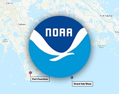
Wave Monitoring Buoy to Serve Useful Purpose
When it comes to tracking approaching storms or gauging water levels offshore, wave monitoring buoy stations perform a critical function in keeping everyone informed about sea surface conditions.
That’s why a recent partnership between the U.S. Army Corps of Engineers and the Coastal Data Information Program (CDIP) to establish one of these buoy stations offshore of Grand Isle and Port Fourchon is a big deal.
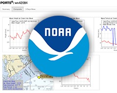
CDIP 246, located 16 miles east of Port Fourchon at 29’5.1′ N, 89’54.5′ W, has recently been installed and become operational.
Every 30 minutes the buoy, which is a 3-foot diameter yellow ball with a flashing light mounted on top of a 6′ antenna for nighttime visibility, will report the latest wave conditions and sea surface temperature. The data is made available in real time at cdip.ucsd.edu, and will be broadcast over the NWS marine radio weather channel. This data will also be accessible by visiting portfourchon.com and clicking on the Weather & Storm Info box at the top of the page.
Additionally, there is tidal data available for Port Fourchon as well. Visit the Greater Lafourche Port Commission to learn more about this data.
The buoy is operated and maintained by the Scripps Institution of Oceanography as part of the nationwide Coastal Data Information Program. Any questions may be directed to www@cdip.ucsd.edu.
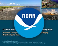
The report is a synthesis of water quality, habitat monitoring and mapping programs in the Gulf of Mexico and focuses on creating an inventory of metadata, including relevant information about data access and protocols. A total of 544 monitoring and mapping programs are catalogued in the inventory. The majority (362; 66%) monitor water quality; 242 (44%) monitor habitats and 219 (40%) collect or create mapping data and map products.
The monitoring inventory will be searchable via a web-based tool to explore data that can inform restoration actions based on the best available science. The beta version will be highlighted at the joint MCoP/GOMA PIT mid-year meeting (January 15-17th 2020 , Mobile, AL). We will be requesting your feedback on the web tool applications and components following demonstrations at the MCoP workshop on January 15h. We hope to see you there! Stay tuned for hotel registration information and draft agendas.